- About MAA
- Membership
- MAA Publications
- Periodicals
- Blogs
- MAA Book Series
- MAA Press (an imprint of the AMS)
- MAA Notes
- MAA Reviews
- Mathematical Communication
- Information for Libraries
- Author Resources
- Advertise with MAA
- Meetings
- Competitions
- Programs
- Communities
- MAA Sections
- SIGMAA
- MAA Connect
- Students
- MAA Awards
- Awards Booklets
- Writing Awards
- Teaching Awards
- Service Awards
- Research Awards
- Lecture Awards
- Putnam Competition Individual and Team Winners
- D. E. Shaw Group AMC 8 Awards & Certificates
- Maryam Mirzakhani AMC 10 A Awards & Certificates
- Two Sigma AMC 10 B Awards & Certificates
- Jane Street AMC 12 A Awards & Certificates
- Akamai AMC 12 B Awards & Certificates
- High School Teachers
- News
You are here
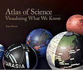
Atlas of Science: Visualizing What We Know
Publisher:
Mit Press
Publication Date:
2010
Number of Pages:
288
Format:
Hardcover
Price:
29.95
ISBN:
9780262014458
Category:
General
The Basic Library List Committee suggests that undergraduate mathematics libraries consider this book for acquisition.
[Reviewed by , on ]
Charles Ashbacher
11/20/2010
On page 3 of this book there is a chart in which one of the data points says that the amount of digital content produced by 2010 is 1 zetabyte or 1,000,000,000,000,000,000,000 bytes. While there is no question that there is an enormous amount of irrelevancy (i.e., crap) in this data, it is also true that there are some real gems that could alter the lives of many people and perhaps change the course of the world. The problem is that extracting the nuggets from this flood of muddy water requires tools that have only recently been developed (after all, they were not needed before the flood). These tools not only need to be able to scan data for key values, they must also be able to dig deeply into the data and ferret out non-obvious patterns To complicate the matter further, the tools must be able to cross-reference multiple data types and display the results in a manner that humans can easily understand.
This book is a collection of maps of data that are attempts to solve this problem. Areas of science and interconnections between them, the numbers of published papers in areas and the number of citations they receive and the temporal movement of incidence of a disease are just some of the subjects of the maps. Many of the maps have a highly original design, making the textual explanation a necessity if you are to understand and appreciate them.
As I was reading this book, I was pleased to reach the understanding that I was seeing the birth of a technology that is newly essential for the continued progress of human scientific and technical endeavors. In the growing isolation due to specialization, cross-subject relevancies are not being spotted and exploited. With these maps, it may be possible to identify them and apply them to critical areas. This is one of the most impressive and promising books that I have ever read.
Editor's Note: High resolution images, all references, and the history of the atlas are available online at http://scimaps.org/atlas.
Charles Ashbacher splits his time between consulting with industry in projects involving math and computers, teaching college classes and co-editing The Journal of Recreational Mathematics. In his spare time, he reads about these things and helps his daughter in her lawn care business.
The table of contents is not available.
- Log in to post comments