- About MAA
- Membership
- MAA Publications
- Periodicals
- Blogs
- MAA Book Series
- MAA Press (an imprint of the AMS)
- MAA Notes
- MAA Reviews
- Mathematical Communication
- Information for Libraries
- Author Resources
- Advertise with MAA
- Meetings
- Competitions
- Programs
- Communities
- MAA Sections
- SIGMAA
- MAA Connect
- Students
- MAA Awards
- Awards Booklets
- Writing Awards
- Teaching Awards
- Service Awards
- Research Awards
- Lecture Awards
- Putnam Competition Individual and Team Winners
- D. E. Shaw Group AMC 8 Awards & Certificates
- Maryam Mirzakhani AMC 10 A Awards & Certificates
- Two Sigma AMC 10 B Awards & Certificates
- Jane Street AMC 12 A Awards & Certificates
- Akamai AMC 12 B Awards & Certificates
- High School Teachers
- News
You are here
Mathematical Treasure: Mayer's Mathematical Atlas
Tobias Mayer (1723-1762) was a self-educated German mathematician and astronomer. Working as a cartographer in 1750, he compiled and published the most accurate map of the moon then available. In 1751, he became a professor of mathematics at Göttingen University from which he carried on an active correspondence with Leonhard Euler.
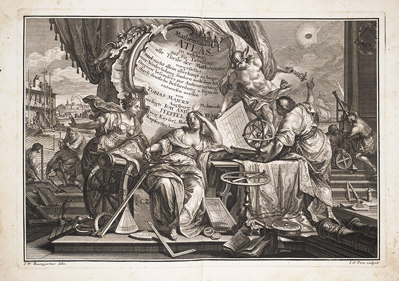
In collaboration with colleagues Johann Baumgarten and Johann Pinitz in 1745, Mayer published Mathematischer Atlas. The book has no title page but begins with a frontispiece (above) showing a busy scene in which a muse of mathematics is besieged by clients seeking help with applications of mathematics.
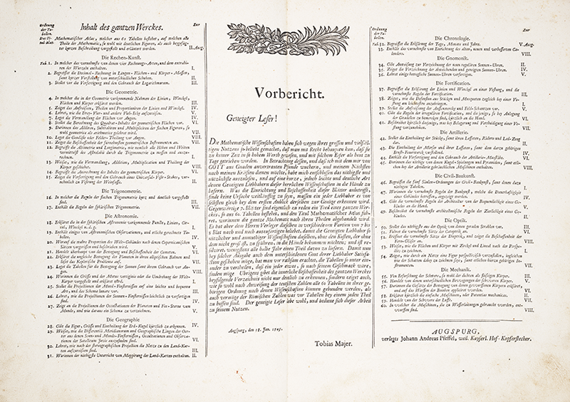
Mayer’s Preface and Table of Contents, above, supply the purpose and scope of the Atlas. Note the wide variety of mathematical applications at this time, including artillery, fortification, banking, optics, and mechanics.
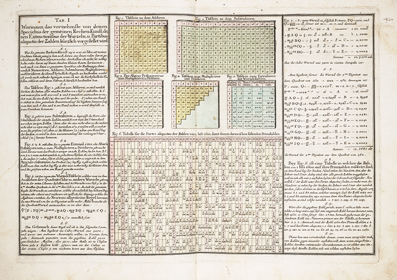
This Atlas contains 63 colored engravings. The first plate (above) contains ten figures for tables of various mathematical operations: addition, subtraction, multiplication/division, numbers raised to various powers, aliquot parts, etc.
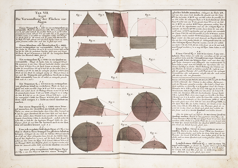
Plate VII, above, illustrates the rectification of selected polygonal areas as well as the rectification of two circles (Figures 8 and 9 in the image above).
These images are supplied through the courtesy of the Linda Hall Library of Science, Engineering & Technology. A complete viewing of these works can be found in the library’s digital collection.
Frank Swetz (The Pennsylvania State University), "Mathematical Treasure: Mayer's Mathematical Atlas," Convergence (January 2016)