- About MAA
- Membership
- MAA Publications
- Periodicals
- Blogs
- MAA Book Series
- MAA Press (an imprint of the AMS)
- MAA Notes
- MAA Reviews
- Mathematical Communication
- Information for Libraries
- Author Resources
- Advertise with MAA
- Meetings
- Competitions
- Programs
- Communities
- MAA Sections
- SIGMAA
- MAA Connect
- Students
- MAA Awards
- Awards Booklets
- Writing Awards
- Teaching Awards
- Service Awards
- Research Awards
- Lecture Awards
- Putnam Competition Individual and Team Winners
- D. E. Shaw Group AMC 8 Awards & Certificates
- Maryam Mirzakhani AMC 10 A Awards & Certificates
- Two Sigma AMC 10 B Awards & Certificates
- Jane Street AMC 12 A Awards & Certificates
- Akamai AMC 12 B Awards & Certificates
- High School Teachers
- News
You are here
Mathematical Treasure: Schwenter’s Geometriae practicae

Illustrations from Daniel Schwenter’s (1585-1636) Geometriae practicae novae et auctae tractatus I-IV, published in 1641, depicted the use of geometry in land survey and measurement. This first scene taken from Book II, page 94, shows the use of two triangles in determining the height of a distant spire.

This illustration from Book III, page 8, demonstrates the use of similar triangles in distance measure.
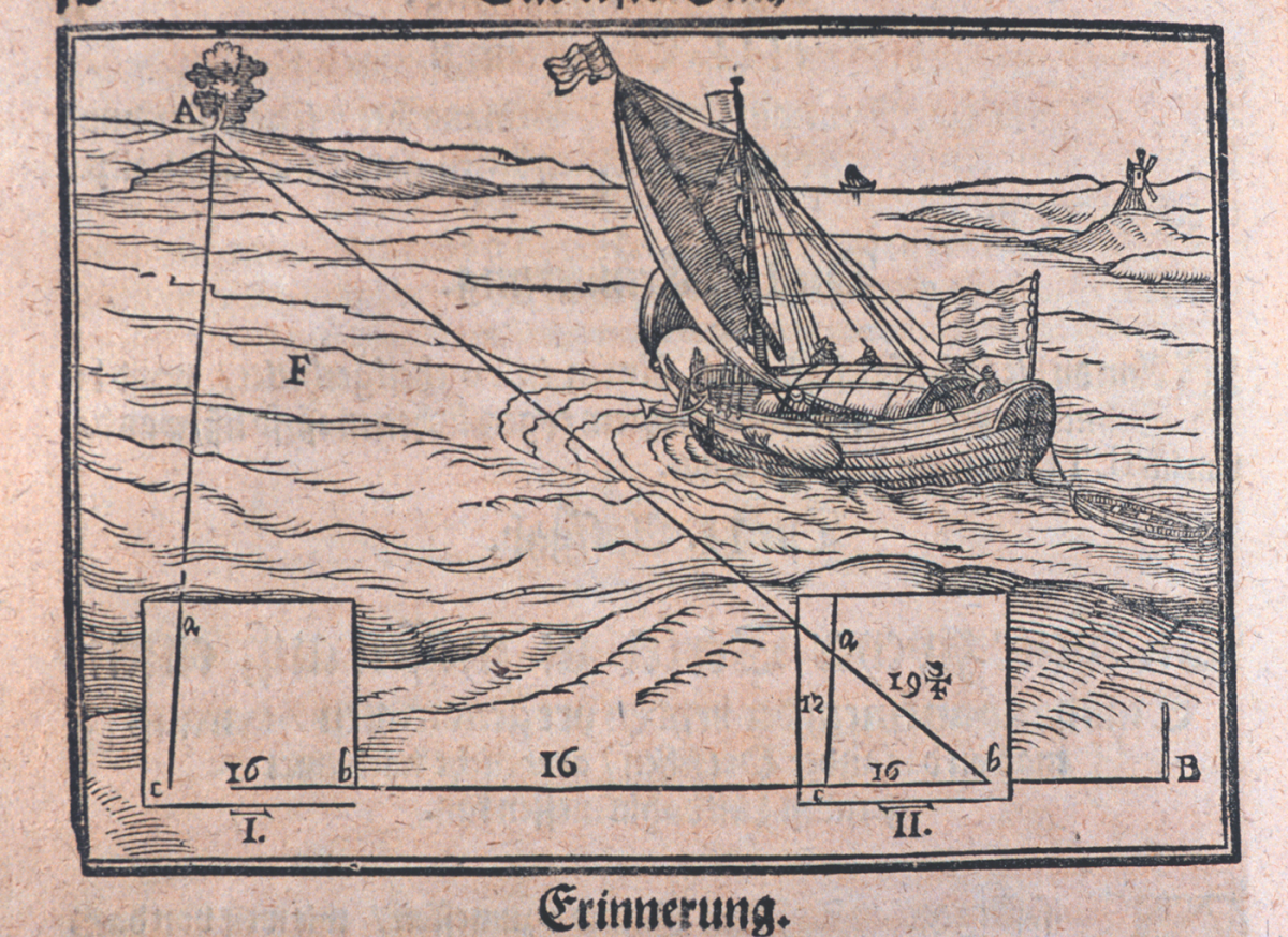
In this picture from Book III, page 12, geometry is used to determine the distance to the shore from the boat at sea.

Geometric triangulation is demonstrated in mapping activities in Book III, page 24.

A clever instrument for observing slope and computing distance simultaneously is shown on page 38 of Book III. Can you figure out how it works?
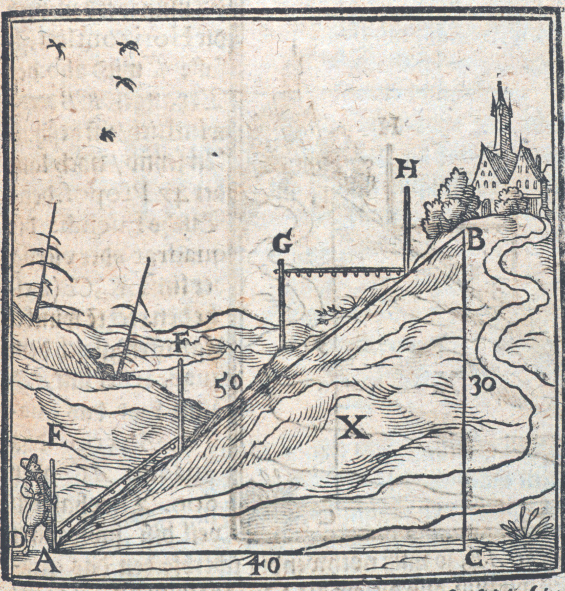
In the image above, the properties of the 3-4-5 right triangle are conveniently used to determine slope and distance.
For images from Daniel Schwenter’s book of mathematical recreations and puzzles, Delicia Physico-Mathematicae, see the Convergence article, “Mathematical Treasure: Daniel Schwenter’s Delicia.” The copy of the book featured there once belonged to the magician Harry Houdini.
The images above were supplied through the cooperation of The Treasures of the National Oceanic and Atmospheric Administration (NOAA) Library Collection. The individual images were photographed by Mr. Sean Linehan.
Frank J. Swetz (The Pennsylvania State University), "Mathematical Treasure: Schwenter’s Geometriae practicae," Convergence (January 2015)